Project74 is an open-ended project loosely aimed at (re-)establishing, preserving, and circumnavigating the former North Riding of Yorkshire.
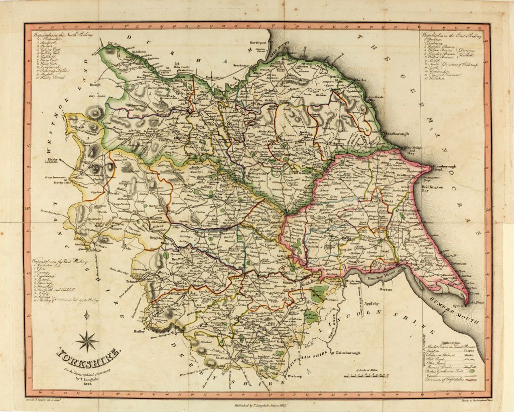
The North Riding is one of three ancient sub-divisions of Yorkshire, along with the East and West Ridings. The term “riding” comes from the Old Norse word þriðjungr, which means “a third”.
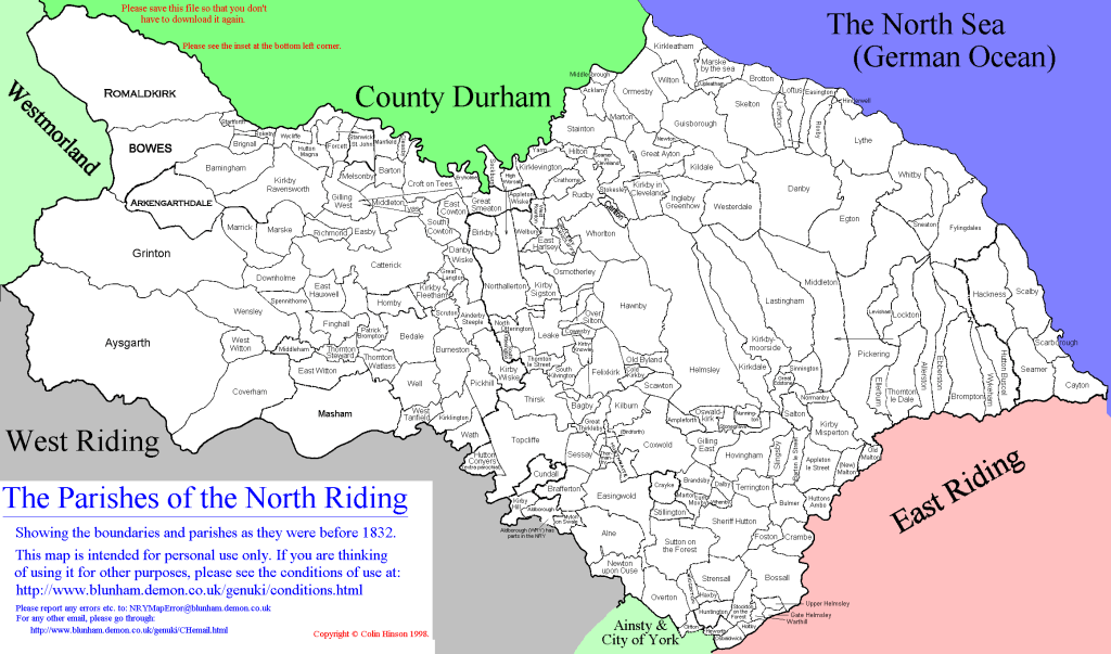
Each Riding was divided into wapentakes, of which the North Riding had 13 when they were abolished in the early 19th century. For more information on the wapentakes see this Genuki page.
The North Riding was adopted as an administrative county from 1889. This was abolished in 1974, when it mostly became a part of the North Yorkshire unitary authority. In the process, areas of old the North Riding became parts of County Durham and Cleveland respectively.
The North Riding comprised individual parishes, which evolved into more numerous civil parishes in the mid 19th century. This accounts for many of the anomalies in its border. See more via Genuki here.

Establishing the North Riding’s borders, over half a century after its effective dissolution, is difficult, not to say impossible, due to countless minor changes over the centuries. Broadly speaking, the boundary is defined by the Tees to the north and the North Sea to the east; cutting inland just north of Filey; roughly following the rivers Hertford and Derwent to and through Malton and down towards Stamford Bridge; heading into York and looping around the minster; snaking the route of the Ouse and later the Ure to just east of Ripon; heading north to loop around Wensleydale and Swaledale and reach Tan Hill; before branching north-west through Upper Teesdale to rejoin the Tees close to its source at Cauldron Snout: a total traverse of some 330 miles.
THE NORTH RIDING WAY

A prospective North Riding Way is necessarily simplified, chiefly along its southern edge, where the largely path-less problem of the Vale of Pickering is avoided by taking the Tabular Hills walk from Scarborough to Helmsley, then the Ebor Way down through the Howardian Hills to York. Sticking to the Ouse and then the Ure, the route strays slightly into the West Riding as far as Ripon, before tracking north and west, and ultimately connecting with the Pennine Way to and through Hawes. Access restrictions at the Warcop firing range make it easier to divert from the Westmorland border, instead cutting in through Stainmore to reach the Tees at Middleton-in-Teesdale. Total distance: 322 miles.
